- NEW UPDATES OF PCIC
- The third seminar on Climate Change Impacts over Turkey area
- Certificate regarding to maintain the high peer review standard
- 2018 Free workshop on WRF-Chem model in ITU
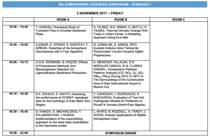
- Symposium – ATMOS 2017
- BOOK; The Climatic Application of Solar Radiation in Environmental Planning
- RESEARCH UPDATES in PCIC
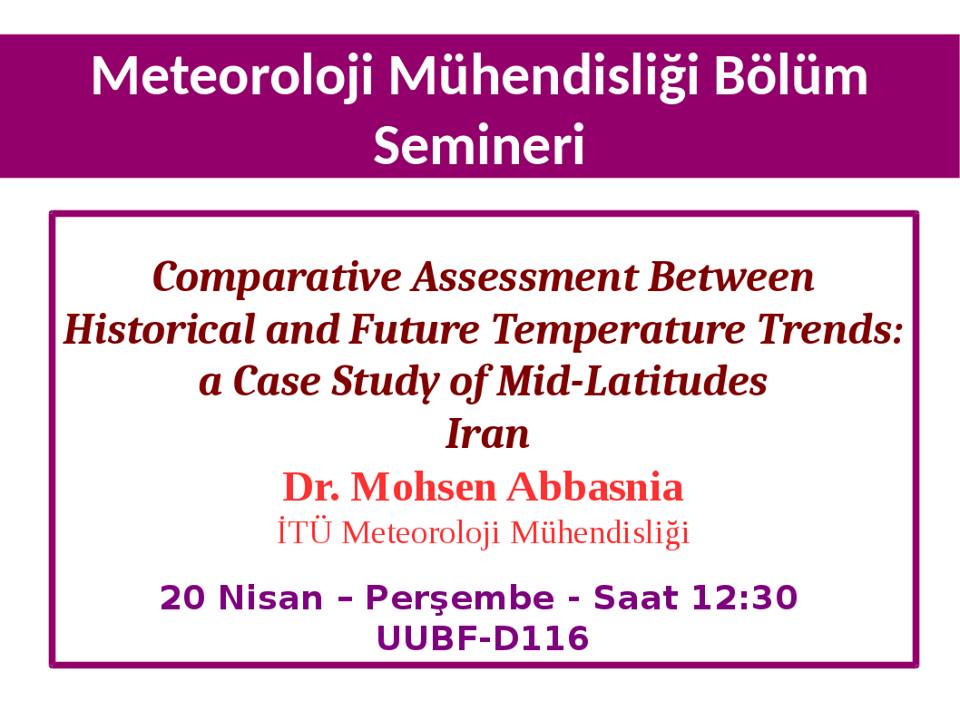
- Lecture: Spatial and temporal changes in the temperature
- Future changes in maximum temperature using the statistical downscaling model (SDSM) at selected st
- Assessment of future changes in the maximum temperature at selected stations in Iran based on HADCM3

آخرین مطالب
امکانات وب
PROJECT AND RESEARCH UPDATES IN PCIC
Project Spotlight: Rivers Climate Change Indicators
In August of 2017, interactive maps that show changes to the timing and volume of river flow, using data from a Referee of the Journals...ادامه مطلب
ما را در سایت Referee of the Journals دنبال می کنید
برچسب : نویسنده : 3climmet2 بازدید : 46
Mohsen Abbasnia, Department of Meteorology, Faculty of Aeronautics and Astronautics, Istanbul Technical University. My main research interests: Climate Change, Climatic Hazard and Regional Climate Modeling, especially Climate Change effects over Middle Eastمحسن عباس نیا: پژو& Referee of the Journals...ادامه مطلب
ما را در سایت Referee of the Journals دنبال می کنید
برچسب : نویسنده : 3climmet2 بازدید : 57
Mohsen Abbasnia, Department of Meteorology, Faculty of Aeronautics and Astronautics, Istanbul Technical University. My main research interests: Climate Change, Climatic Hazard and Regional Climate Modeling, especially Climate Change effects over Middle Eastمحسن عباس نیا: پژو& Referee of the Journals...ادامه مطلب
ما را در سایت Referee of the Journals دنبال می کنید
برچسب : نویسنده : 3climmet2 بازدید : 67
Dear Colleagues,
Istanbul Technical University (ITU), Department of Meteorology is organizing the WRF-Chem EU 2018 workshop in Istanbul, Turkey on 3-4 May 2018: http://www.atmosfer.itu.edu.tr/wrf-chem/ The main goal of this workshop is to allow users from different institutes across Europe and neighboring countries share their experience and scient Referee of the Journals...ادامه مطلب
ما را در سایت Referee of the Journals دنبال می کنید
برچسب : نویسنده : 3climmet2 بازدید : 71
 با سلام
به پیوست فایل نهایی شده لیست مقالات انتخابی برای ارائه سخنرانی در هشتمین سمپوزیوم بین المللی آورده شده است، که همانطور مشخص است از ایران نیز مقالاتی مورد پذیرش کمیته علمی علوم اتمسفری قرار گرفته است. با آرزوی موفقیت روزافزون و دیدار ایرانیان در محافل علمی آینده
List of final presentation in the
01 – 04 November 2017 Istanbul – TURKEY
Topic Categories: Science News (مطالب علمی جدید) Referee of the Journals...
با سلام
به پیوست فایل نهایی شده لیست مقالات انتخابی برای ارائه سخنرانی در هشتمین سمپوزیوم بین المللی آورده شده است، که همانطور مشخص است از ایران نیز مقالاتی مورد پذیرش کمیته علمی علوم اتمسفری قرار گرفته است. با آرزوی موفقیت روزافزون و دیدار ایرانیان در محافل علمی آینده
List of final presentation in the
01 – 04 November 2017 Istanbul – TURKEY
Topic Categories: Science News (مطالب علمی جدید) Referee of the Journals...ما را در سایت Referee of the Journals دنبال می کنید
برچسب : نویسنده : 3climmet2 بازدید : 70
 با سلام حضور دوستداران علوم محیطی و اتمسفری
به پیوست فصل بندی و متن کامل فصل اول از کتاب ارزشمند جناب پروفسور دکتر تقی طاوسی در رابطه با نقش انرژی خورشیدی در محیط زیست ارائه می گردد، که علاقه مندان میتوانند از طریق لینک زیر به آن دسترسی پیدا کنند. این کتاب که در سال جدید به چاپ دوم رسیده است از منابع آزمون دکترای اقلیم شناسی و همچنین از منابع درسی دوره دکترای دانشجویان اقلیم شناسی می باشد، به طور گسترده به تشریح و توضیح انرژی خورشیدی و نقش آن در سامانه حرکتی جو و ساختار های مربوط به آن در هدایت و استفاده از این منبع انرژی تجدید پذیر پرداخته است.
لینک دسترسی و دانلود کتاب
Topic Categories: Free Book Offer (معرفی کتاب) Referee of the Journals...
با سلام حضور دوستداران علوم محیطی و اتمسفری
به پیوست فصل بندی و متن کامل فصل اول از کتاب ارزشمند جناب پروفسور دکتر تقی طاوسی در رابطه با نقش انرژی خورشیدی در محیط زیست ارائه می گردد، که علاقه مندان میتوانند از طریق لینک زیر به آن دسترسی پیدا کنند. این کتاب که در سال جدید به چاپ دوم رسیده است از منابع آزمون دکترای اقلیم شناسی و همچنین از منابع درسی دوره دکترای دانشجویان اقلیم شناسی می باشد، به طور گسترده به تشریح و توضیح انرژی خورشیدی و نقش آن در سامانه حرکتی جو و ساختار های مربوط به آن در هدایت و استفاده از این منبع انرژی تجدید پذیر پرداخته است.
لینک دسترسی و دانلود کتاب
Topic Categories: Free Book Offer (معرفی کتاب) Referee of the Journals...ما را در سایت Referee of the Journals دنبال می کنید
برچسب : نویسنده : 3climmet2 بازدید : 102
Project Spotlight: Rivers Climate Change Indicators
In August of 2017, interactive maps that show changes to the timing and volume of river flow, using data from analysis performed at PCIC, were published. These accompany updates to a British Columbia (BC) Ministry of Environment and Climate Change Strategy (MoECCS) report on climate indicators in BC, to which PCIC has also contributed. Rivers and the ecosystems that they support provide a variety of services to communities in the province. Changes to river flow can result in impacts, such as floods, that affect these services.
Seventeen stations—places where river flow data is recorded using gauges—were suitable for trend analysis, six with records extending back for about 100 years and 11 with records for about the last 50 years. Most stations showed significant increases in minimum daily flow and insignificant decreases in maximum daily flow over 1912-2012, while the magnitude and direction of change in mean annual and seasonal flow varied by river basin. Changes in river flow depends on a basin’s location, size, elevation, and flow regime. Changes in flow volume for the 55-year period, 1958-2012, were similar to those f Referee of the Journals...ادامه مطلب
ما را در سایت Referee of the Journals دنبال می کنید
برچسب : نویسنده : 3climmet2 بازدید : 53
 What’s happening?
1- The increasing range in future maximum temperature are estimated about 2-4 °Cg/ A2 SRE, 1-2 °Cg/ B2 SRE and average rising 1.5 °Cg/all SREs.2- The highest trend slopes in annual maximum temperatures are found by 0.69, 0.68 and 0.62 °Cg per decade at Isfahan, Tabriz and Tehran stations {Geographical conditions: high latitudes, high elevation} based on A2 SRE , respectively. While the lowest trend slope is found by 0.14°Cg per decade at B-Abbas station {Geographical conditions: high atmospheric humidity, low height and low latitudes} based on B2 SRE.3- The maximum temperatures in the northe mountainous with drier climate will expect to be more rising changes in tem Referee of the Journals...
What’s happening?
1- The increasing range in future maximum temperature are estimated about 2-4 °Cg/ A2 SRE, 1-2 °Cg/ B2 SRE and average rising 1.5 °Cg/all SREs.2- The highest trend slopes in annual maximum temperatures are found by 0.69, 0.68 and 0.62 °Cg per decade at Isfahan, Tabriz and Tehran stations {Geographical conditions: high latitudes, high elevation} based on A2 SRE , respectively. While the lowest trend slope is found by 0.14°Cg per decade at B-Abbas station {Geographical conditions: high atmospheric humidity, low height and low latitudes} based on B2 SRE.3- The maximum temperatures in the northe mountainous with drier climate will expect to be more rising changes in tem Referee of the Journals...ما را در سایت Referee of the Journals دنبال می کنید
برچسب : نویسنده : 3climmet2 بازدید : 42
Modeling Earth Systems and Environment
June 2016, 2:68 | Cite as
Future changes in maximum temperature using the statistical downscaling model (SDSM) at selected stations of Iran
Cite this article as:Abbasnia, M. & Toros, H. Model. Earth Syst. Environ. (2016) 2: 68. https://doi.org/10.1007/s40808-016-0112-z
http://rdcu.be/xQ0D
Referee of the Journals...ادامه مطلب
ما را در سایت Referee of the Journals دنبال می کنید
برچسب : نویسنده : 3climmet2 بازدید : 82
Assessment of future changes in the maximum temperature at selected stations in Iran based on HADCM3
Asia-Pacific Joual of Atmospheric Sciences
August 2016, Volume 52, Issue 4, pp 371–377 | Cite as
Assessment of future changes in the maximum temperature at selected stations in Iran based on HADCM3 and CGCM3 models
Cite this article as:Abbasnia, M., Tavousi, T. & Khosravi, M. Asia-Pacific J Atmos Sci (2016) 52: 371. https://doi.org/10.1007/s13143-016-0006-z
http://rdcu.be/xQ1e
Referee of the Journals...ادامه مطلب
ما را در سایت Referee of the Journals دنبال می کنید
برچسب : نویسنده : 3climmet2 بازدید : 34